Historical Resources
The Landscape of Dodona
The ancient site of Dodona is in Epirus, northwest Greece, 22km south of the modern city of Ioannina. The sanctuary lies in the long, narrow Tcharacovitsa valley, on a small plateau between the south-eastern slopes of Mount Olytsika (ancient Tomaros) and the plain of Ioannina. It sits at the foot of a small hill, on which stood the ancient town of Dodona.
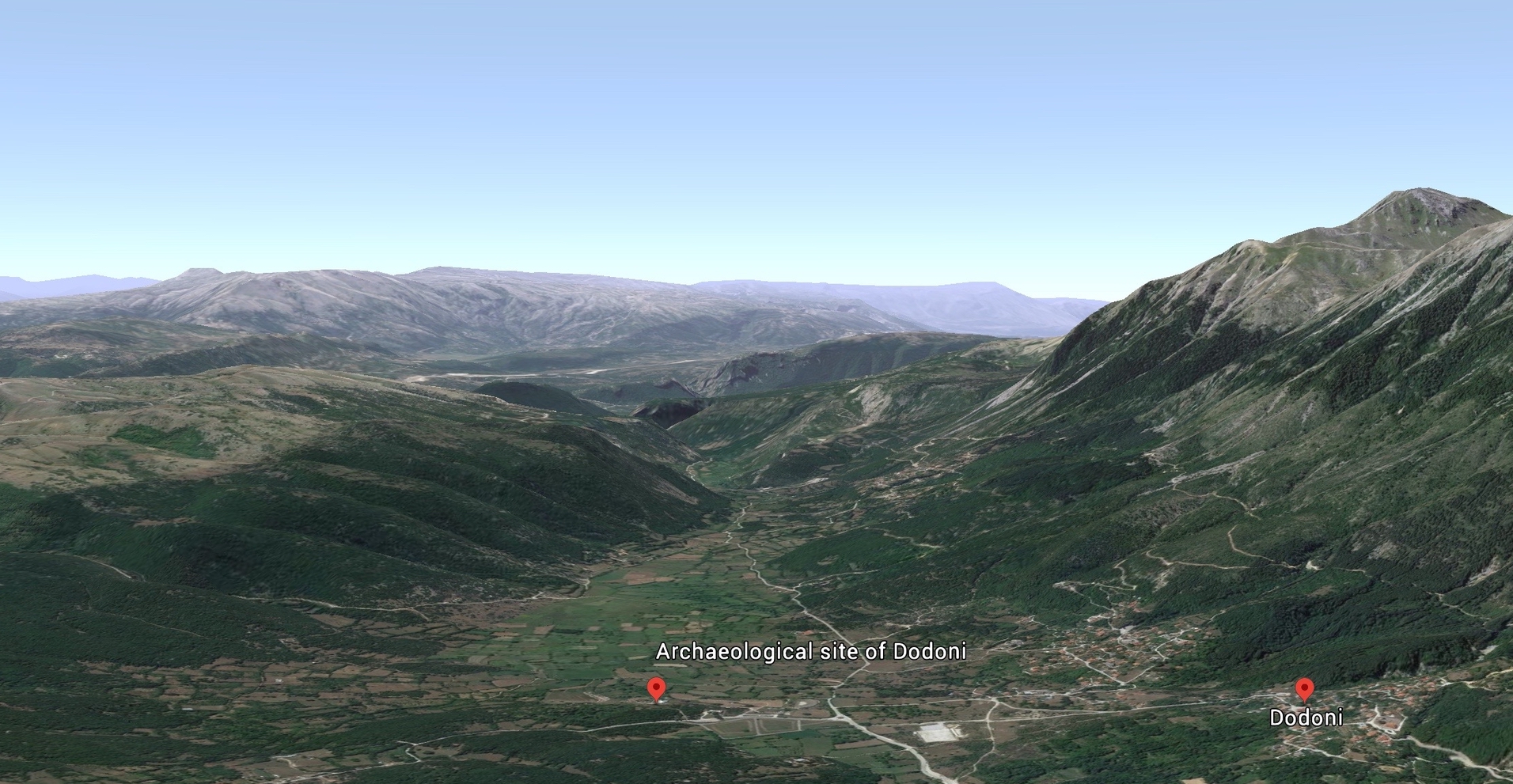
Source: Google Earth.
The area was heavily wooded in antiquity. It is likely that there were extensive forests in the valley and on the Ioannina plain, with many different species of oaks, which dominate forest vegetation in Greece. The Kermes oak (quercus coccifera) was perhaps most abundant on the Ioannina plain; deciduous forest would cover the lower slopes of Olytsika, with Greek fir, black pine and beech at higher elevations.
Source: Zac Peterson / Google Earth
The climate of Ioannina is distinctive for its high rainfall (three times as great as at Athens). This is mostly in winter, when there are also frosts and heavy snowfall. Hammond reports that, during WWII, Greek soldiers suffered more from frostbite than from enemy action. In summer, the area is famous for its thunderstorms and heavy rains. The ancient experience seems to have been similar: the myth of the great flood which Deucalion and Pyrrha survived is meant to have begun in this area (Aristotle Meteorologia 352a); while in Homer’s Iliad (16.233-238), Dodona is described as duscheimeron or 'wintry’.
The melting snows on Mount Olytsika help to feed springs and streams, many of which flow in subterranean channels through the valley. There are also a number of springs in the valley of the sanctuary and some streams. The plateau forms a low watershed between the rivers Louros and Thyamis (Kalamas). The source of the Louros flows from the edge of the plateau, south of Dodona, down to the Gulf of Ambrakia. In ancient times, the Louros river valley provided one of the routes to the sanctuary taken by ancient pilgrims.
Constantin Carapanos, who first excavated the site of Dodona at the end of the nineteenth century, remarked on the numerous springs at the foot of Mount Olytsika, which produced both marshy land that was hard to cultivate and beautiful meadows. Ancient writers evoke a similar scene: the seventh century BCE poet Hesiod described the area’s rich meadows and many grazing sheep and cattle (Eoiai Fr. 97); Strabo (7 fr 1c and 2), quoting Apollodorus, refers to the marshes around the shrine, and Pliny the Elder (Natural History 4.1) refers to Dodona’s ‘hundred springs’.
Pliny also mentions a specific spring at Dodona, which only flowed between midnight and noon, and which put out torches but then reignited them (Natural History 2.106); other ancient writers (Servius commenting on Virgil’s Aeneid 3.466) reported a spring that flowed from between the roots of the oak. No evidence, however, exists for such a spring, and it is likely that this was a later addition to the accounts of divination.
References
- Carapanos, C. 1877. ‘Dodone et ses ruines’. Revue Archéologique, 33, 397-405.
- Hammond, N.G.L. 1967. Epirus: The Geography, the Ancient Remains, the History and the Topography of Epirus and Adjacent Areas. Oxford: Clarendon Press.
- Hammond, N.G.L. 1997. ‘Physical Features and Historical Geography’ in Epirus: 4000 Years of Greek History and Civilization, edited by M.B. Sakellariou, 12-31. Athens: Ekdotike Athenon S.A.